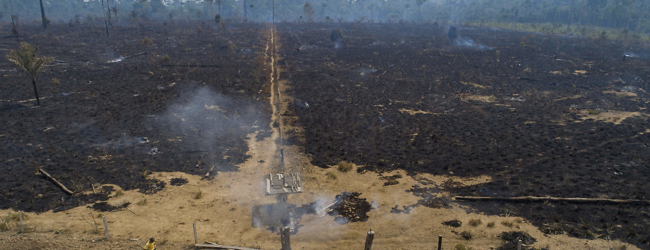
An area of forest destroyed by fire near Novo Progresso, Brazil, in August 2020. Experts say the blazes are pushing the world's largest rainforest toward a tipping point, after which it will cease to generate enough rainfall to sustain itself. (AP Photo/Andre Penner)
Deforestation has traditionally been viewed as an environmental issue, but, increasingly, illegal logging in rainforests is being understood as an issue of transnational organized crime. Forests cover 31 percent of the planet, are home to 80 percent of the world’s terrestrial species of animals and plants, and provide for the livelihoods of 1.6 billion people. Yet rising deforestation rates are destroying their rich biodiversity in several parts of the world. In the Amazon basin, forest destruction is driven primarily by illegal activities such as land invasions, induced forest fires (usually set to clear land for agriculture, ranching, and land speculation), and illegal mining and logging.
The more immediate negative impacts of these activities are often felt locally—not only through environmental degradation, but also through intensifying conflicts, violence, and inequalities. The broader effects are not bound by the biome itself either, or by political boundaries. For example, deforestation accounts for 17 percent of all global carbon emissions.
This represents not only massive environmental impacts at a planetary scale, but also huge economic costs. The estimated loss in revenue from illegal logging alone costs timber producing countries between $10 to 15 billion per year. Stolen wood is estimated to depress world timber prices by up to 16 percent each year. In spite of these impacts, effective strategies to curb illegal deforestation are hard to find.
Part of the problem is a lack of adequate forest monitoring, which is complicated by the challenges to obtaining accurate and consistent spatial data on deforestation. Even when greater accuracy and reliability are achieved—for instance, with the support of satellite technologies that allow for real-time tracking and increasingly detailed surveillance of forest canopies—filtering large amounts of data can be slow, labor intensive, and expensive. The enormous troves of data that can now be gathered through the deployment of drones pose similar challenges.
Some of the most promising innovations for enhancing the monitoring of forests involve artificial intelligence (AI) and associated technologies, such as deep learning and machine learning. So-called “earth-friendly AI” has been touted as a way to vastly enhance data collection and analysis for environmental conservation. Some of these new technologies are being developed and applied elsewhere in the world, but they may be adaptable to the Amazon basin through adequate government support, robust policy frameworks, and international cooperation.
First, AI can enhance the accuracy of forest monitoring. For example, data science company Gramener has used Convolutional Neural Networks with transfer learning to predict plant and tree species from close to 675,000 images, achieving 85 percent accuracy—a level comparable to that achieved by human experts.
Some organizations install sensors for monitoring rainforests. IBM’s analytics-driven software InfoSphere Stream processes over 10,000 data points per second generated by sensor networks measuring carbon levels, soil moisture, relative humidity, and atmospheric pressure in Brazil, among other places. Conservationists and researchers use the software to predict droughts and forest fires and to assess how rainforests respond to deforestation and climate change.
The non-profit organization Rainforest Connection (RFCx) relies on acoustic monitoring systems to help fight illegal deforestation in real-time, including in Amazon basin countries like Brazil, Ecuador, and Peru. Team members strategically place recycled cell phones in rainforests and the devices send instant notifications to rangers when they detect the sound of a chainsaw, which helps to curb not only illegal deforestation, but also poaching of local species. In addition, a cloud-based database of animal sounds gathered through this method allows researchers and governments to document and track wildlife, including endangered birds and mammals.
Second, AI can help make forest data more reliable. Some actors have achieved this by linking AI to crowdsourcing. For instance, Global Forest Watch (GFH), an online platform that takes millions of satellite images with the help of crowd-sourcing, helps conservation organizations by counting trees in ways that contribute towards improved forest management and tracking illegal deforestation.
Third, AI can also speed the data analysis process exponentially. In Brazil, for example, new satellite constellations are being coupled with AI and cloud computing to vastly expand the technical capacity to map and monitor Brazilian lands. GFH’s platform has proven useful in identifying recent illegal mining activities, and its near-real-time alerts have helped government authorities in places like Amapá, on the border with French Guyana, to pinpoint illegal deforestation sites that should be prioritized by law enforcement agencies.
Finally, AI can help build up local capacity for forest monitoring, for instance through partnerships with local communities. In the Brazilian state of Pará, the Tembé indigenous people have been facing relentless illegal logging, poaching, and drug smuggling operations in their lands. The community has been working with RFCx to deploy a monitoring system that alerts trained Tembé Rangers to signs of illegal logging (for instance, chainsaws), poaching (motorcycles), and smuggling (trucks/vehicles). In another example, São Paulo-based MapBiomas uses remote sensing, GIS, and cloud-based computing to generate a historical map series of land cover and use in Brazil, using satellite images to identify pixel patterns for different types of activities leading to deforestation. Mapbiomas builds capacity by working through networks of organizations, including NGOs, universities and companies, in order to bring together specialists in remote sensing and information technology.
Some of the innovations entail attempts to predict where deforestation will occur, so as to help inform decision-making about land use and guide conservation efforts. Identifying patterns in road construction in forested areas, or the expansion of illegal gold digging into protected lands, can be useful for establishing priorities for responses, from strengthening law enforcement to boosting conservation efforts.
It can also help raise public awareness of the encroachment on protected areas. For instance, the World Resources Institute (WRI) has used spatial modeling software and an artificial neural network architecture to map the links between past forest loss and its drivers in these landscapes, whether tied to biophysical factors (elevation, slope, and precipitation), accessibility (distance from roads, settlements, rivers, conflict, and shifting cultivation), or land management (forest concession and protected areas). As data on how landscapes have changed in the past is inputted, the model “learns” and adapts until it arrives at the most accurate linkages between past loss and drivers. The model then ranks the influence of various forest loss drivers in those landscapes and produces a map showing areas at high risk for forest loss. At the University of California, Berkeley, scientists are working to combine AI with historical “dark data”—unarchived, non-digital legacy data such as reports, field notes, journals, biological specimens, correspondence, and artifacts—to track environmental change, in ways that may be applicable in the Amazon.
AI is far from a silver bullet. It needs to be linked to effective policies for environmental conservation, protection of local communities, and better law enforcement within and across borders in order to have any real impact. Detailed monitoring, for instance, is of little use if law enforcement is incapable of acting on the information provided, and even accurate predictions will amount to nothing if conversation efforts do not follow through. For governments like Brazil, which has been actively dismantling institutions in charge of environmental protection and even encouraging land invasions, political factors limit the uses of such technologies. Likewise, safeguards must be put in place to prevent abusive uses of the data collected, such as repressive surveillance of Amazon communities and non-governmental organizations. However, under a responsible, fair government bent on curbing illegal deforestation and its associated socio environmental injustices, AI can help prevent at least some of the environmental disasters we are currently witnessing in the Amazon and in other biomes.
This article is part of a series on climate change.